
Day 13: Burgos - Hontanas
Distance: 30.6 km(19 miles)
Approximate Walking Time: 7-8 hours
Altitude: Start at 856 m(2,808 ft.), ascend up to 900 m(2,952 ft.) near Hornillos, descend down to 825 m(2,706 ft.) at Hornillos, ascend again to 900 m(2,952 ft.) and end at 870 m(2,854 ft.)
 We left Burgos at 6:00 a.m. when they opened the albergue for everyone to leave. Some albergues didn't open their doors until 6:00 and some had a door that locked from the outside, that way anyone could leave but no one could just walk in. We joined a group of people we'd met at the start and all of us worked together to follow the sea shells out of town. At times, the trail crossed the street from the left side to the right and back again. Eventually, we arrived at the edge of the city and headed out into the morning's darkness. We walked the next few km to the town of Tardajos. There, a nice man took us to the local bread factory because the bartender refused to sell us a loaf of bread. He told us someone had helped him when he was walking the Camino and when he saw us get shot down for bread, he knew it was his turn. It was a humbling gesture of kindness. Aside from the bread factory, there wasn't much to see in Tardajos except the old church.


 Just 2 more km from Tardajos was the small village of Rabe de las Calzadas. It was a bit smaller than Tardajos but the houses were more beautiful. Most were made of large brown stone and had the old style Spanish doors. We followed the trail through the town and back out into the golden hay fields.


 The fields weren't as bright and golden as normal without the morning light shining on them. Whenever it was overcast, it felt colder and the wind blew harder. About the time we left Rabe de las Calzadas, the bikers started to pass us. The bikers shared most of the Camino with the walkers except in certain parts where they used the National Roads. We never saw them until 9:30 or 10:00 and they continued to pass us throughout the day until we stopped. Biking the Camino from Saint Jean is another option and it only takes a little less than 2 weeks to bike the entire length.


 Another 8 km from Rabe was Hornillos del Camino. It was recommended as a stopping point for the day but since we arrived at 11:00 a.m., we had no intention of calling it a day. They did have a 5 euro municipal albergue with a kitchen but the supermarket left a lot to be desired. Buy things to cook in Burgos if you plan to stay in Hornillos. It rained on us while we sat and took a much needed break. There was a big descent into Hornillos and we walked in with a couple of Canadians we'd met at the beginning. One thing that we all talked about a lot was how we were going to pamper ourselves at a beach after we finished. A lot of times, our minds focused on something positive when the Camino became tough or monotonous. From Hornillos, we walked 10 km to Hontanas. We passed through the same fields kilometer after kilometer. The only sounds we heard were the crunching of our feet on rock, the crackling of the fields, and the sounds of hunting season. One positive thing about the Camino was that we almost always could see the town where we wanted to stop off in the distance. Not this day as Hontanas was down in a bowl. At one point, we passed a sign telling us we had .5 km to go and we still couldn't see it.
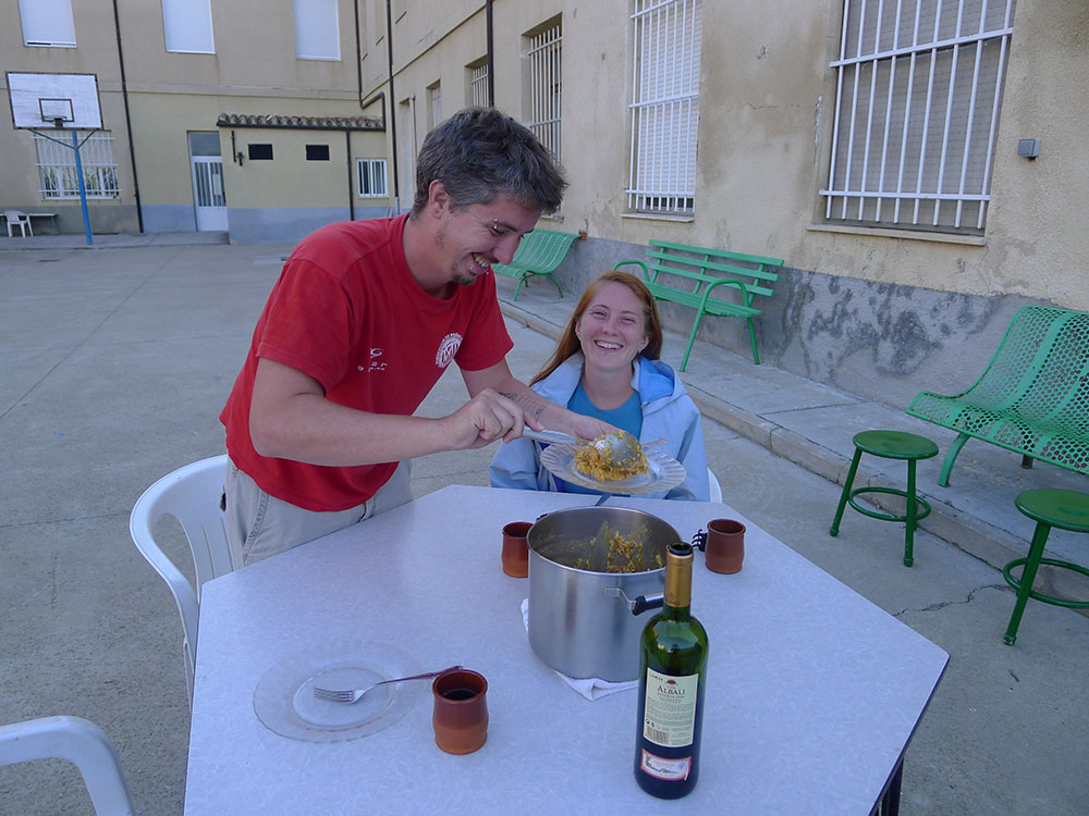
 Hontanas was a small village of about 60 people. All of the buildings looked quite similar and were made of large brown stone. We checked in to the municipal albergue for 5 euros because they had a kitchen. There was no internet. There were two other albergues for 4 and 6 euros a piece. We were the first to arrive and could pick any bed we wanted. Our room had 8 bunk beds and we took two bottom ones because we didn't want to bother with climbing up a shoddy ladder with sore feet. There were several restaurants in town but none looked like a stand out place. We purchased a few things from the supermarket, otherwise known as a cooler and some vegetables in some guy's bar. We made a nice vegetable soup for dinner. The town had a couple of nice churches, a hermitage, and a photo gallery of the Camino. It was run by two hippies who were trying to be artistic but came off as quite pompous. There tag line was that they had walked the trail so many times that they didn't count kilometers anymore. I have news for them, everyone who walked through that town counted the kilometers to and from it. Hontanas wasn't the most exciting of towns but our first 30 km day took it out of us. We were also introduced to two constant nuisances that would be one of the worst parts of the walk across the Spanish meseta, flies and the smell of cow manure.


Day 14: Hontanas - Boadilla
Distance: 28.4 km(17.6 miles)
Approximate Walking Time: 6.5-7.5 hours
Altitude: Start at 870 m(2,854 ft.), descend to 804 m(2,638 ft.) at Castrojeriz, ascend up to 920 m(3,018 ft.) just after Castrojeriz and back down 765 m(2,510 ft.) at Boadilla.
 We slept well in Hontanas and woke up rather chipper at 5:45 a.m. the next day. Even the pervasive smell of manure didn't dampen our mood. We washed and packed and left at 6:15. It was one of the clearest mornings of the whole trip and the walk under the stars was a delight. It never got old staring at the sky as we walked. The trail went on out of town and followed along a narrow path at the base of a large hill. We saw a couple of people walking along the road in the distance and the Camino eventually rejoined the road as walked into San Anton, a small village that exists as a few houses surrounding an old abandoned monastery. It was built by Alfonso VII in the 12th century as a hospital and refuge for pilgrims on the Camino de Santiago. Now, they are preserved as ruins of the medieval building it once was. From there, we marched on a few more km to Castrojeriz.


 Castojeriz sits at the base of a large hill that has a fortress at its top. One of our friends told us that it had been built to provide protection for the Roman gold rush at Las Médulas outside of Ponferrada. The castle itself dates back to Roman times, was modified by the Visigoths and Moors during their respective occupations of Iberia and later severely damaged by an earthquake in Lisbon in 1755. Seismologists estimate that earthquake to have been somewhere between an 8.5 - 9 on the Richter scale and the effects were felt as far away as Finland so it's not surprising the castle was damaged.

 The city itself holds a lot of historical importance in Spain. From the 8th - 14th centuries, Spain was inhabited by the Moors of North Africa. The town of Castrojeriz was returned to the kingdom of Castilla sometime near the end of the 10th century, which was considered progress in repelling the Moors south. The houses in the town were built around the Camino de Santiago and its also one of the longest stretches of the Camino through a town that doesn't change to another street. We found a couple of churches in town, the main one being St. John's Church. It had 3 naves and was built before the gothic influence. We stopped at the first hostel in town because they had a cafe and the owner helped me find the local bread delivery driver for our morning baguette.


 The clouds melted away as we left and the sun started to shine. On the other side ofCastrojeriz, we could see the mountain we had to climb. The ascent stared us down as we approached and up up up we went to around 930 m(3,051 ft.) from 805 m(2,641 ft.) in town. After nearly two weeks of walking, we had grown accustomed to the ups and downs of the trail. We went at our own pace and never really got tired. There were a couple of younger kids who ran on up. At the top, it looked like some giant had sliced off the peak. It was completely flat until we arrived to the other side and had to go down. The bikers really struggled going up but the trail was paved going down and they just cut loose and made the rest of us walking jealous.


 From Itero de la Vega to Boadilla, the trail was a bit boring and monotonous. Earlier, we had the mountain to climb and that provided us with nice views. The rest of the way, we went through more crackling hay fields that offered no place to sneak off and pee. This was more of a problem for Izzy than me. As we walked, we begged the clouds to cover the sun a bit but they didn't cooperate so we put on sunscreen. The trail was lined with large rocks that hurt your feet the entire way to Boadilla. As we arrived, we passed a shepherd with his dogs and flock. We found some interesting sand sculptures there but it was nearly impossible to snap any photos because the flies kept trying to carry us off.

 We stopped for a bit at the entrance to the town because we thought of walking on to the next. We checked out the albergue there but they wanted 7 or 8 euros and didn't have a restaurant. We walked on into town and checked out the Casa Rural "En el Camino" and checked in. They charged 6 euros for a bed and 9 euros for dinner, communal style. They served dinner at 7:00 and 8:30. This allowed the Spaniards to eat later as they like to do and the rest of the world could eat at 7:00. We had delicious chick pea soup and roast beef for dinner. One thing rings true all around the world, small town cooking can't be beat. It wasn't elegant and refined but it was delicious and filling. We had a walk around the town. It was quiet except for a couple of groups of old men sitting around shooting the breeze. There was a famous statue in front of St. Mary's Church decorated with animal designs and others symbols of the Camino. The town was famous too as one of the boundary places between the Christian and Muslim lands during the Moor occupation. The smell of manure was so strong that I became convinced it was part of the foundation of the town. The flies outside were so bad it almost became pointless to even try to swat them away. Fortunately, most people have beaded curtains hanging in their doorways to keep the flies out of the houses.


Day 15: Boadilla - Carrión de los Condes
Distance: 26.9 km(16.7 miles)
Approximate Walking Time: 5.5-6.5 hours
Altitude: Start at 765 m(2,510 ft.) and slowly ascend to 830 m(2,723 ft.) at Carrión de los Condes.
 We slept on and off throughout the cacophony of snorers, bed rustlers, and night talkers. The noise became unbearable around 5:30 a.m. Instead of continuing to fight it, we got up, packed our things, and headed out into the unescapable stench of manure. Leaving Boadilla was simple but there was a key left turn a kilometer outside of town that could easily be missed. When we saw the turn, we used our small lights and looked for a few minutes before finding the small yellow arrow to lead us left. We met a few people who missed the turn because they couldn't find the arrow in the dark. A couple of kilometers after turning, we came to a fork in the trail and chose to go left as there was no clear indication. We should have stayed right but we found a small trail leading back to the original. It was clear we weren't the first to take the wrong turn. We walked for a bit longer and arrived to Fromista around 8:00 a.m. It's one of the biggest towns with nearly 1,000 people. It had a famous landmark, the Saint Martin Church and several other smaller churches. It also had a famous work of art with cultural significance to the Camino de Santiago. Of course, we didn't get to see these things because none of them were open at 8:00 a.m. We had to settle for a walk around the town and off we went towards Población de Campos. As Izzy shows you below, always fill your water bottle whenever you find a fountain.


 We spent the rest of the day walking alongside the P-980 National Road. While it wasn't as nice to simply walk alongside the road, we did enjoy having the kilometer markers letting us know how much further we had to go. We passed by Población de Campos, Revenga de Campos, Villarmentero de Campos, Villalcázar de Sirga, and ended at Carrión de los Condes. Most of the towns were set back from the highway and all offered albergues, cafes, and rest areas with water fountains and picnic tables.
 Here's a statue dedicated to pilgrims in Revenga de Campos. It was a nice town.
 We started to see directions spray painted on the roads directing us to various bars and albergues.


 The last 6 km to Carrión de los Condes was long and hot. From time to time, the clouds would cover the sun and give us a small reprieve. We stopped in Villarmentero around 10:00 a.m. There was a nice albergue by the road with a large open grass area and tons of tables. A lot of people stopped for a coffee break and some were having pints of beer. Yikes! Villalcázar was the last major town before Carrión. It's famous for its 12th century St. Mary's Church built by the Templars. There are many historical accounts of the protection the Templars provided for pilgrims as they walked to Santiago.

 Carrión de los Condes has been inhabited since the pre-Roman days. Archaeological evidence dating as far back as the 3rd century BCE has been found in and around the city. It was full of various churches, the most famous being Our Lady of Bethlehem Church, several medieval hospitals, some hermitages, and the famous Saint Zoilo Monastery. Our first stop was the local tourist office to get a map and directions to the albergue Espíritu Santo. It was a convent run by nuns now used as a shelter for pilgrims. They charged 5 euros and had some nice rooms. They even had a computer room with a small box for you to put in money whenever you used the computer. Sadly, the computer was quite old and couldn't do more than one thing at a time. It seems PC incompetence is worldwide. We showered, washed our clothes, and headed out to explore the town.
 Walking through the streets of Carrión de los Condes felt like walking back in time. Everything was old and well preserved. Many people slowly meandered through the streets going about their daily business. We went to the Our Lady of Bethlehem Church but it was closed for the afternoon siesta. It became impossible to get anything done from 3 - 5 p.m. in the small towns as the only activity people believe should exist at those hours is eating, drinking, and sleeping. From the church, we followed the Camino out of town to visit the famous Monastery of Saint Zoilo. It was built in the 10th century and became famous along the Camino de Santiago as a place that fed the pilgrims wine and bread. The monastery was under renovations when we visited but we were still able to see lots of the original architecture, the recently discovered sarcophaguses of the Counts for which the town is named, and some Islamic rugs dating to the 11th century. The visit was 1.50 euro. In Spanish style, an over priced hotel is attached to the monastery and used the old rooms as the guestrooms.


 After our wander around the town, we went to the supermarket and bought a few things to cook a jambalaya, or American paella as our friend would call it and relax with some wine. Also in Spanish fashion, an old guy saw us cooking at 6:30 p.m. and asked us why we were eating so early and if that meant the world was ending. Later that night, his wife forced us out of the room with her unbearable snoring. We slept the night in the computer room. In the morning, before we left, we took a mental picture of her. That way, if she showed up at the same albergue, we could leave or get a bed far far away from her. I hate to be one to say it but some people make the Camino a bad experience.

Distance: 30.6 km(19 miles)
Approximate Walking Time: 7-8 hours
Altitude: Start at 856 m(2,808 ft.), ascend up to 900 m(2,952 ft.) near Hornillos, descend down to 825 m(2,706 ft.) at Hornillos, ascend again to 900 m(2,952 ft.) and end at 870 m(2,854 ft.)


Day 14: Hontanas - Boadilla
Distance: 28.4 km(17.6 miles)
Approximate Walking Time: 6.5-7.5 hours
Altitude: Start at 870 m(2,854 ft.), descend to 804 m(2,638 ft.) at Castrojeriz, ascend up to 920 m(3,018 ft.) just after Castrojeriz and back down 765 m(2,510 ft.) at Boadilla.


We walked on for a few km and found the Fitero Bridge. It stands at the edge of the province of Burgos near the Saint Nicholas hospital for pilgrims. The hospital seemed to still be open to pilgrims. The bridge is dated from the 10th century and attributed to Alfonso VI. It connects Burgos Province with the province of Palencia over the Pisuerga River. We passed a nice sign welcoming us to the province. The next town was Itero de la Vega and was a decent sized town with almost 200 residents. That doesn't sound like a lot but when the last place you stayed in had 20, 200 seems huge. There was a nice albergue at the entrance to the town and we found a supermarket but it was closed due to it being Sunday. We had some lunch in a square near the market and listened to the church bells ring for twenty solid minutes. We rested for a bit and took some pictures of the town before walking on to Boadilla, our destination for the day.


Day 15: Boadilla - Carrión de los Condes
Distance: 26.9 km(16.7 miles)
Approximate Walking Time: 5.5-6.5 hours
Altitude: Start at 765 m(2,510 ft.) and slowly ascend to 830 m(2,723 ft.) at Carrión de los Condes.


No comments:
Post a Comment