
Day 22: Rabanal del Camino - Molinaseca
Distance: 25.5 km(15.8 miles)
Approximate Walking Time: 7-8 hours
Altitude: Start out at 1150 m(3,773 ft.), rise up to 1,500 m(4,921 ft.) and walk at that altitude for 5 km and descend down to 580 m(1,903 ft.).
 I don't think we slept any better the entire hike as we did the night after walking 35 km to Rabanal. We were treated to yet another orchestra of snoring and farting. The morning presented us with a problem that also ensured we wouldn't hike that much in one day again, our clothes didn't dry. We had to use some spare clothes we had packed and hang the still damp ones from our bags so they could dry as we walked. We headed out a little before seven and finally had a bright moon to give us some light. We sliced our way through a mountainside ascending up, up, up.

 The first small town we came to was Foncebadón, a small village of twenty or so people 6 km from Rabanal. The morning light was just breaking over the horizon and put a golden glow on everything. Most of the valleys were filled with big puffy clouds. The views were incredible and we went at a slower pace because we were looking at everything around us while navigating the tough path of rocks.


 After passing through Foncebadón, we continued on ascending up to the highest point of the French Path of the Camino de Santiago at Cruz de Ferro. The wooden post measures almost 5 meters (16 ft.) tall and the cross atop is made of iron. The original cross is housed in the Camino de Santiago museum in Astorga. A couple of interesting theories about the cross's origin say that it dates back to the Roman occupation and signaled a territory boundary. Another theory says that it was erected to provide pilgrims with an easy to see marker of the trail.
 There was a well marked path around the cross and many people left stones there as part of a way of marking that they had passed by. There were lots of benches and lots of people who drove up to spend the day enjoying the beautiful views around the area. From the Cruz de Ferro, we went down into a shallow valley and passed by the small stopover town of Manjarín. There was a small outpost type place to stop and have a coffee. The smart ass at the bar directed us to the woods to find a bathroom. The views were beautiful and we saw more valleys full of clouds.


 After passing through Manjarín, we ascended back up and began a steep descent down towards our destination for the day, Molinaseca. As we walked down, we met a nice guy and his mom who were walking the trail. We didn't know it at the time, but we would see them everyday until we arrived to Santiago. Both were kind and humble people and the mom blew us away when she told us she was 78 years old. The funny part was that her son was having to half jog to keep up with her walking pace. The view of Ponferrada off in the distance was incredible. We stopped for a bit in El Acebo to take a break and have our sandwich snack. It was a small town nestled in the side of the mountain and had lots of older folks out doing their everyday activities.


 The trail from El Acebo to Molinaseca was rugged and there was no shade whatsoever to block the hot sun. The trail was drier and it seemed a lot dustier than other places with so many people walking and kicking up dirt. I saw several people having to put on knee braces and move slower than normal through the descent. Fortunately, my knee didn't cause me any problems. We saw the usual progression of yellow arrows directing us along the path and they were accompanied by blue ones going the opposite direction. We wound our way around a small mountain and finally saw Molinaseca a few hundred meters off in the distance.


 Above is one of the three representations of Santiago. Here he is the pilgrim. We found two albergues, one private and one public. The private cost around 10 euros and the public was 5 euros and even had the option of sleeping outside. The kitchen was pretty bare boned but had enough for us to cook some dinner. The beds were all upstairs and the building had big windows that allowed in a lot of natural light. We went through our normal progression of washing our clothes and ourselves and rested for a bit. An older guy was next to us practicing some meditations to relax. I wonder if it worked.


Day 23: Molinaseca - Villafranca del Bierzo
Distance: 30.2 km(18.8 miles)
Approximate Walking Time: 8-9 hours
Altitude: Start at 580 m(1,903 ft.) and descend down to 512 m(1,680 ft.) at Ponferrada, continue descending to 489 m(1,604 ft.), ascend up to 600 m(1,969 ft.) and end at 500 m(1,640 ft.).
 We headed out a little later than usual because we caught up on some much needed rest. Even at 7 a.m., it was still dark outside. We walked along a long stretch of road that cut through a small town and took us into Ponferrada. It was another town of the Roman rule and actually dates back even further into the Neolithic period. Many hikers went on into the city instead of staying in Molinaseca like us and after getting there, I began to regret our decision to stop.

 One of the first major sites we came to was the Castle of the Templar Knights. It was built in the 12th century over the confluence of two rivers. Some believe it was built over the site of a previous Celtic Temple. The Knights of the Templar were rumored to have provided protection to the pilgrims of the Camino de Santiago. Unfortunately for us, the castle wasn't open at 8:30 a.m. so we were only able to take some photos and try to imagine what it looked like on the inside. We walked up the right side of the castle to a main square next to a large Cathedral. There we could see a huge and clock tower and lots of small cafes lining the square. The city proved to be beautiful and we treated ourselves to some pulgas(a small puff pastry with chorizo inside) at a local bakery.


 After staying longer than we probably should have, we headed on out of town. We followed the yellow arrows through the city. Along the way, we passed several schools and voiced our thanks that we didn't have to worry about returning to our own for work. After a good hour of criss crossing the town and passing through an old hospital, we left behind the outskirts of Ponferrada. The view of the coming mountains was always in sight and in the back of our minds. It had only been a day since our last climb but it wasn't as steep as our first day's climb up the Pyrenees.

 As we walked through the small towns, we saw lots of people roasting red peppers on small top grills. It's a famous tradition in the Bierzo region of Spain to roast red peppers for over an hour and enjoy their wonderful flavor. The trail for the most part followed along a small country road and our feet loved having pavement underneath instead of uneven rocks. We spent most of the morning walking through various small farming communities. None of them had albergues but the last one had a hotel or two. After the last small community, we arrived to Camponaraya. There, we found a small place to stop and have a snack and rest. We saw this awesome mural on the wall next to our stopping point.


 There was a nice picnic area just outside of town where the trail dips back out into the countryside. Our next stop would be the town of Cacabelos, a famous wine town. We weaved our way through tons of vineyards on a dirt path. The best part of hiking the Camino in September was watching the grape harvest. You can literally stop and watch them cut the grapes and load them into tubs that are then carried into town.

 Cacabelos begged us to stop but we had other intentions of getting further along the Camino. The town had beautiful buildings and a wine culture that was great. The trail followed the main road into town along a street lined with beautiful houses and tasty looking restaurants. We stopped at the first church we found and had lunch. The albergues there cost 5 euros and the municipal one was located at the far end of town, which is great when you are ready to leave in the morning.

 We slowly walked through the town, taking in all of its sights. We saw some familiar faces of friends we'd met. Most of them were stopping for the night and we couldn't blame them, it was a beautiful town.

 Hindsight is always 20/20 and in hindsight, we should have stopped. The next two hours of hiking were brutal. Our rule of thumb had been to stop by 1:00 or 2:00 in the afternoon before the day's heat became unbearable. We broke our own rule and continued on in high heat, uphill, and our packs feeling heavier by the second. We climbed our way out of town and started cutting through vineyards again, watching the harvests. Quite a few bikers passed us and I never felt more envious of someone in my life. My near breaking point happened when all of my water became hot.

 We went up and down, up and down and finally made it to Villafranca del Bierzo. Our idea for continuing on was based on knowing we'd have to climb a huge mountain first thing in the morning instead of later in the day. We decided we'd rather ascend when it's cooler rather than when we're nearing the end of the day. The two main albergues were right along the Camino at the entrance to the town. We chose to stay at the Ave Fenix and paid 6 euros a piece. They didn't have a kitchen but that was fine because we'd carried enough stuff to make sandwiches. We washed ourselves and our things and headed into town to poke around.
 Once we were free of our bags and clean and a little rested, we were able to really appreciate the location of Villafranca del Bierzo. It's nestled in the hills of the mountains and the many white buildings against the greenery of the mountains makes for beautiful landscape. The town itself sits down in a bowl and thus, from the albergues, you have a bird's eye view of everything. It's no wonder that the town's roots trace back to the Neolithic times and the Bronze Age. We walked down into town and visited the supermarket and some of the local sites, like the Saint Nicholas Church(from the 17th century) and the Castle. Villafranca is a town just big enough to need some time to explore but small enough it can be easily done in an afternoon.

 We ran into some people we'd met very early in the Camino and hadn't seen for two weeks. The one amazing thing about the Camino was the way you ran into people. Some people we saw daily and others would come and go along the way. There was a huge plaza in the middle of town with lots of restaurant terraces. We also sat for a while and stretched our bodies on a nice grassy area across from Saint Nicholas Church and next to the Collegiate Church of Saint Mary. It's just not a small Spanish town without at least one church dedicated to Saint Mary. Around dusk, we headed back to the albergue, where we slept in the "young person's room." It, thankfully, was free of snoring and could have provided one of the most peaceful nights but the town was having a celebration in which fireworks exploded and music played until 3 a.m.

Day 24: Villafranca del Bierzo - O Cebreiro
Distance: 30.5 km(19 miles)
Approximate Walking Time: 8-9 hours
Altitude: Start at 500 m(1,640 ft.) and ascend up to 600 m(1,969 ft.) continue for 12 km at a steady altitude then ascend up to 1,293 m(4,242 ft.).
 The next morning, we rose early and hit the trail around 6:15 a.m. We knew the day was going to be one of the toughest yet and we wanted to get through it got hot. We followed the trail through Villafranca del Bierzo and ascended up out of town. The trail followed the town's famous Calle del Agua. The country road we were on headed up into the mountains and led us around to the highway. We walked underneath it for a while guided by the light of the moon and the occasional hiker with a headlamp. Around daybreak, we started to arrive to the first of many small towns we would pass that day. The first two were called Pereje and Trabadelo. The trail led us through them but if we had wanted to skip them, we could just continue along the main road. We walked through both towns and they were nothing more than old houses and some stores.
 From Trabadelo, we crossed under the highway's overpass and headed over to La Portela de Valcarce. It was a bit tricky following the arrows and there were several paths that looked like they could have been the Camino but weren't. We rested at La Portela next to another statue of Santiago the Pilgrim.

 As we left La Portela, we could see the mountains in front of us but never the one we were going to climb.
 Over the next couple of hours, we passed through the towns of Ambasmestas, Vega de Valcarce, and Ruitelan. Vega de Valcarce was a recommended stopping point if we had stopped in Cacabelos. It had several albergues but we weren't able to find out how much they were charging. After visiting Vega de Valcarce, I changed my mind on wanting to have stopped in Cacabelos. There was nothing to do and not much to see there. The trail followed the small country road through all of the towns and farms associated with them. We saw many cows and some horses that were showing off and racing with each other as people passed.


 Suddenly outside of Vega de Valcarce, the trail started to rise and rise and rise. As noted in the altitude for the day, we were about to double our distance above sea level. The trail cut off from the road and returned to rock and dirt paths.
 The first part of the ascent looked like the picture below. It was hot and the trail passed by tons of fields full of cows and their excrement. This made for a climb full of sweat, flies, and terrible smells. It was by far much worse than the first day.
 There were some small enclaves along the way and we stopped at one to get an ice cold Aquarius and rest for a bit. We watched a local dog terrorize a guy every time he walked past it. We met him later in O Cebreiro and he turned out to be a guy from Florida who'd just started the trail in Astorga. He had a rough day and the dog exacerbated his frustration.

 The views became even more stunning as we got higher and the climb became a bit gentler. The first part was difficult but it got better as we went on. The trail left the shade of the tree canopy and followed along an old dirt road. There were two more towns to stop in, La Faba and Laguna de Castilla. Both were small farm communities with streets freshly paved with cow poop, one or two small cafes, and a water fountain.
 One of the best parts of that section of the Camino were the grasshoppers. They were everywhere and had beautiful blue and red colors when they opened their wing and jumped. We caught a couple on our bags.
 Just a few kilometers before arriving to O Cebreiro, we reached this important point, the Galician border. We both felt a huge relief knowing we were entering the last of the regions of Spain we would have to get to Santiago.
 As the trail finally started to level off, we realized that we had arrived to O Cebreiro. There was a huge plaque dedicated to the Camino de Santiago with a depiction of all the Caminos that come from various European countries. We walked through the town to the municipal albergue at the far end of town. It was five euros. We later learned that all of the Galician municipal albergues had the same price of 5 euros and none of them had kitchenware.

 We washed ourselves and our things and hung them out to dry. We awoke from a short nap to find it pouring rain outside and we had to run out and get all of our things off the line. This led us to another interesting cultural encounter of a big difference between Europeans and Americans, the automatic dryer. There were two dryers and a lot of people with wet clothes. I spent a good half hour waiting in line and chatting with different people I had seen along the way. When my time came, I loaded the dryer along with a couple of Spaniards and an Italian guy. None of them really understood how the dryer worked. They all expected the 30 minutes we paid for to dry lots of really wet clothes. After a good 30 minutes, I paid for 30 more and everyone seemed baffled that the clothes weren't dry. After the second 30 minutes, we all had to take our stuff out and hang it up a little longer because the people behind us in line were growing antsy. I tried to explain to everyone how the dryer worked as it dried our clothes.
 After the clothes were dry, we walked around the town. All of the buildings were made of stone and some had thatch roofs. We found a lot of old farming equipment and a litter of kittens that provided a lot of entertainment. There was a small church dedicated to Saint Mary and other places of cultural significance like old pilgrim hospitals associated with the Camino de Santiago. The town's founding dates back to the Pre-Roman times.

 We had dinner at a local Casa Rural with our friend Shawn we'd met from Colorado. We saw the old guy who had chased the dog around the town further down the mountain too. We chatted about life back in the U.S. and enjoyed our dinner of soup, pasta, and ribs. We had to hurry back to the albergue before 10:00 p.m. because they lock the doors everyday to provide peace and quiet for the resting pilgrims and we didn't want to rest outside in the cold. Surprisingly, it was relatively quiet considering the large amount of people sharing the room with us.

Distance: 25.5 km(15.8 miles)
Approximate Walking Time: 7-8 hours
Altitude: Start out at 1150 m(3,773 ft.), rise up to 1,500 m(4,921 ft.) and walk at that altitude for 5 km and descend down to 580 m(1,903 ft.).


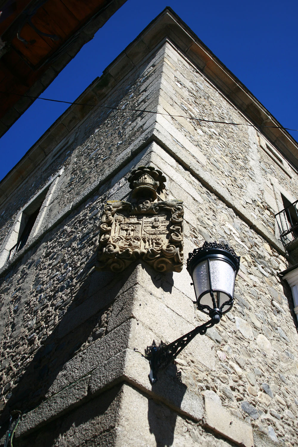


We wandered through the town for a bit checking out the buildings. A lot of people were relaxing by the small river with a swim or just napping in the sun. For most of the bikers, they could just jump right in without changing out of their clothes. We had a beer at a local place and combed through the grocery stores for something to cook for dinner. The town was quaint and full of many nice old house made of stone with wooden balconies. The town dates back to the 17th century and probably existed as a place of residence for workers in the local iron mine.

Day 23: Molinaseca - Villafranca del Bierzo
Distance: 30.2 km(18.8 miles)
Approximate Walking Time: 8-9 hours
Altitude: Start at 580 m(1,903 ft.) and descend down to 512 m(1,680 ft.) at Ponferrada, continue descending to 489 m(1,604 ft.), ascend up to 600 m(1,969 ft.) and end at 500 m(1,640 ft.).


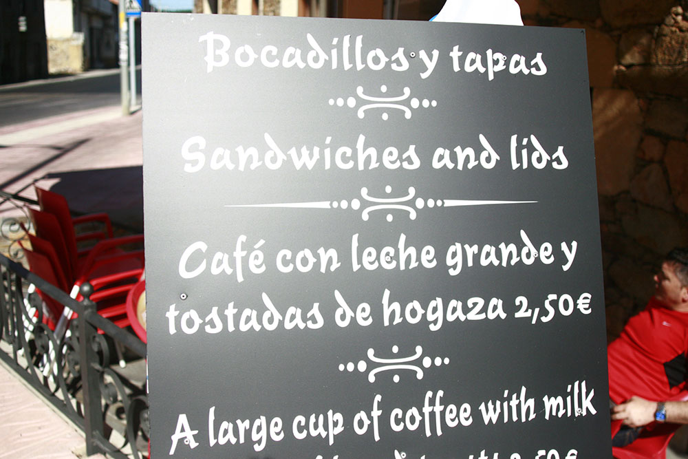
After two years of teaching English to Spaniards, some signs just couldn't escape our meticulousness. For instance, this proprietor was not wise to the fact that a tapa is not a lid. While technically it's the right translation, it completely misses the meaning.


Day 24: Villafranca del Bierzo - O Cebreiro
Distance: 30.5 km(19 miles)
Approximate Walking Time: 8-9 hours
Altitude: Start at 500 m(1,640 ft.) and ascend up to 600 m(1,969 ft.) continue for 12 km at a steady altitude then ascend up to 1,293 m(4,242 ft.).


No comments:
Post a Comment